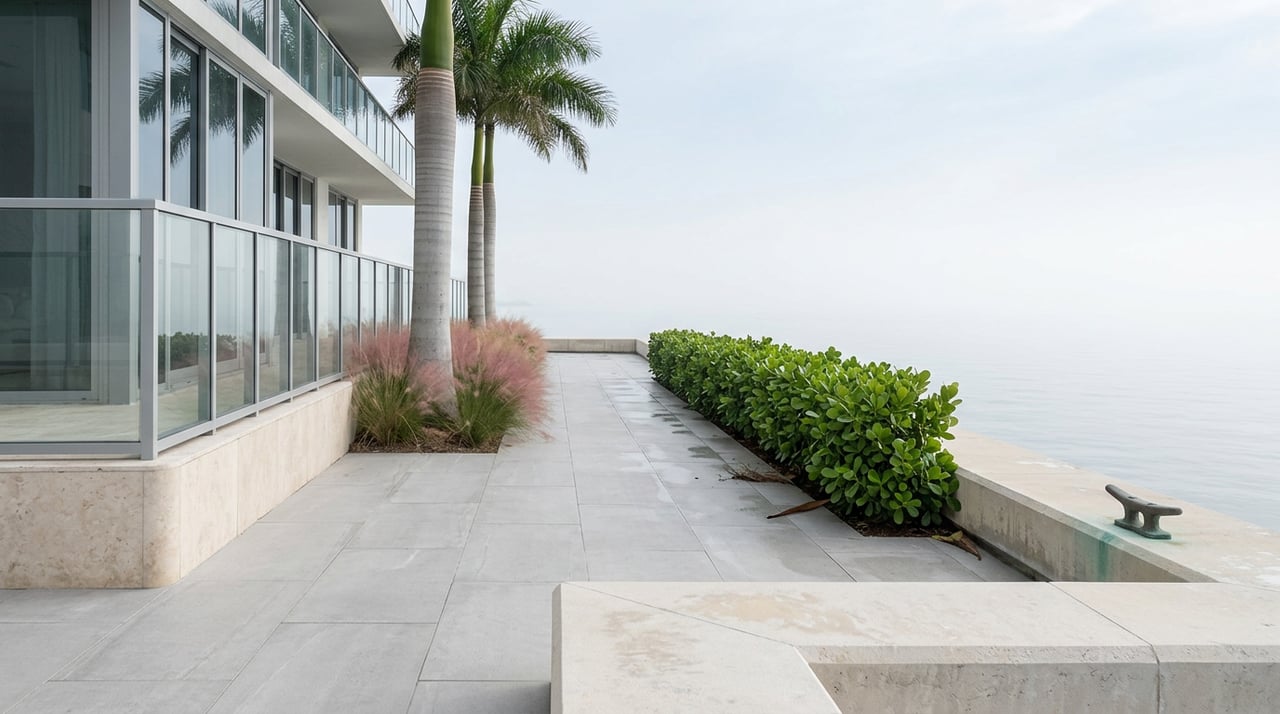
Walk south from the Paraiso towers on a Saturday morning and the bay stays on your left for nearly a mile without a single detour sign. Keep going past Margaret Pace Park, cross into downtown, and the same unbroken feeling carries you past the Arsht Center's shadow, through Museum Park, and into the plazas outside Bayside Marketplace. Then, just past the Frost Museum of Science, the path stops. Not narrows. Stops. You're standing at the edge of I-395, and the only way forward is a twenty-minute detour around an off-ramp that Miami's own downtown planning staff has described as a real safety hazard for anyone on foot.
That contrast is the story. Miami's waterfront isn't one long promenade nearing completion. It's four separate projects, each run by a different owner, each on its own schedule, and each one finishing at a different pace than the others. If you live in this stretch of the city, from Edgewater down through downtown and Brickell, knowing which segment belongs to which timeline is the difference between a walk that flows and one that ends at a chain-link fence.
Why the Route Comes in Pieces
The reason Miami's bayfront isn't a single continuous path traces back to a 1979 charter amendment. Miami voters required any new building along Biscayne Bay or the Miami River to set back from the water's edge and provide public access, which is why so many condo towers built in the last two decades carry their own stretch of baywalk as a condition of construction. But the rule only applies going forward. Buildings that predate 1979 were never required to open a path along their shoreline, which is exactly why the route through Edgewater and the stretch near the MacArthur Causeway still reads as patchwork instead of a finished line. The walk isn't unfinished so much as it's permanently tied to redevelopment timing, one parcel at a time.
That single fact reframes almost everything else worth knowing about the water right now.
What's Actually Walkable in One Stretch Today
If you want a route you can do this week without hitting a barrier, here's what currently holds together:
- Downtown's Museum Park corridor, anchored by the 21-acre Maurice A. Ferré Park, which houses both the Pérez Art Museum Miami and the Frost Museum of Science as bookends connected by landscaped paths and bay-view benches.
- Bayfront Park south into Brickell, where the path runs past Bayside Marketplace and continues largely unbroken toward the Brickell Avenue Bridge.
- The Underline's first two phases, running from the Miami River through the Roads, Shenandoah, and Silver Bluff neighborhoods to SW 19th Avenue, a stretch that's fully open and has been since April 2024.
- The northern Edgewater segment, which opened in 2019 and connects Sea Isle Marina down to Margaret Pace Park. It's the piece most residents underuse, according to local reporting on the neighborhood's waterfront, probably because it doesn't yet connect cleanly to anything south of it.
Put those four together and you have a genuinely good walk. What you don't have, yet, is one walk.
The Last Big Gap, and Why the Bridge Won't Open This Year
The stretch under I-395, between Museum Park and the north side of the MacArthur Causeway, is the piece everyone in downtown Miami and Edgewater eventually runs into. On March 12, 2026, Miami city commissioners approved the design for what's being called the I-395 Baywalk Pedestrian and Bikeway Bridge, a roughly 600-foot span that would finally link Maurice A. Ferré Park to the waterfront just north of the causeway. The city selected a design called the Bay 2-Enhanced Connector and authorized a grant application to help cover an estimated $2.14 million first-phase budget. City projections suggest the completed link could generate between $1.46 million and $1.95 million in additional annual property tax revenue once it's built, largely by connecting neighborhoods that currently sit a car ride apart on foot.
Here's the part that matters if you're planning your fall around this: the design approval isn't a construction start. City staff still have to lock in remaining funding and clear permitting before a contractor breaks ground. There's no firm completion date yet. If you've been waiting for this link to open before you commit to a regular walking or biking route between downtown and the Venetian Causeway, plan on waiting through at least this year, and likely longer.
North of Downtown, the Walk Depends on the Season
Margaret Pace Park sits at the southern edge of Edgewater and functions as the connective tissue between the bay's northern segment and downtown. It's also about to become a construction zone. The community center planned for the park is set to break ground in late 2026 and run through 2028, part of a broader master plan that also brings a renovated entrance, kayak launch areas, and two coastal pavilions designed by Touzet Studio, one shaped like an abstracted mangrove for the baywalk side.
That timeline has a practical consequence for anyone walking or running through the neighborhood over the next two years. The construction is concentrated on the park's south end, which means the baywalk north of NE 24th Street becomes the more reliable route until the work wraps. If your regular loop runs through the park's southern half, expect noise and possible rerouting through at least the next two summers.
Edgewater is also getting less car-dependent in ways that matter for this same stretch of waterfront. A 2026 update on Miami-Dade's Freebee shuttle service confirmed an expansion into Edgewater and Midtown with a stop connecting to the 15th Street Metromover station, giving residents a free alternative to driving on days when walking the whole route isn't practical. And on July 7, 2026, Gioia Hospitality Group signed a lease for an 11,500-square-foot waterfront restaurant at a luxury development on Edgewater's northern edge, with an outdoor bar and interiors from the Rockwell Group. It's a small detail, but it tells you where the neighborhood's foot traffic is expected to land next: directly on the water, not set back from it.
The Underline's Quiet Second Act
South of Brickell, a different piece of infrastructure is closing in on its own finish line. The Underline's third and final phase, a 7.36-mile segment running from near the Vizcaya Metrorail station down to Dadeland South, is expected to be completed sometime in 2026. When it's done, the build will have added roughly 1,800 trees and about 350,000 native plants to the corridor, along with bioswales and Dark Sky-compliant lighting. The first two phases already draw nearly 3 million visits a year, according to Miami-Dade County figures, which gives a sense of how much demand exists for this kind of inland, shaded alternative to the open bayfront.
For residents in Brickell specifically, Phase 3's completion means the linear park under the Metrorail tracks will finally offer a continuous route all the way to Dadeland, no detours through side streets required.
Where the Segments Stand This Fall
| Segment | Current status | What it means for you |
|---|---|---|
| Downtown Museum Park to Brickell | Largely open, connects PAMM, Frost Science, Bayfront Park | Reliable year-round walking route |
| I-395 underpass (Museum Park to MacArthur Causeway) | Design approved March 2026, no construction date set | Still requires a detour around the ramp |
| Margaret Pace Park, south end | Construction starts late 2026, runs to 2028 | Use the segment north of NE 24th Street until it clears |
| The Underline, Phase 3 (Vizcaya to Dadeland) | Expected completion in 2026 | Brickell to Dadeland becomes one continuous corridor |
What This Means If You Live Here
None of these four projects are racing each other, and none of them were designed as one system. They're separately funded, separately timed, and tied to different agencies: the City of Miami on the Baywalk pieces, Miami-Dade County on the Underline, and individual developers on the segments that come with new towers. That's worth knowing not because it changes how far you can walk this weekend, but because it explains why the "almost done" framing you see elsewhere doesn't quite hold up. There isn't a single ribbon-cutting coming. There's a rolling set of them, spread across years, each one closing a specific, named gap rather than completing one master plan all at once.
If you're already living along this stretch, from Edgewater through downtown into Brickell, the practical move is to treat the walk the way locals treat it: know which segment is open this month, route around the one that isn't, and expect the map to look different again by next fall. For a closer look at what's changed and what's coming across downtown and the surrounding waterfront, our Miami neighborhood guide tracks these updates as they land, and our Brickell page covers what the Underline's final phase means for that end of the corridor specifically.
If you're weighing a move to this part of the city and want a read on how these infrastructure timelines line up with what's actually for sale along the water, Sergey Shulga can walk you through it block by block. Schedule a Consultation to talk through the neighborhoods where this waterfront work is furthest along.